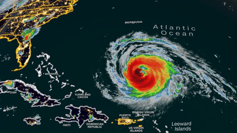
Hurricane Lee continues to strengthen in the Atlantic, just east of the Leeward Islands. The storm’s winds are up to maximum sustained speeds of 80 mph (130 km/h). Forecasters are predicting that Lee could become a major hurricane with winds of at least 111 mph (179 km/h) within the next 24 hours, as it begins to make a pivotal turn to the northwest.
The National Hurricane Center (NHC) says that Lee will soon reach an area where environmental conditions could allow for intensification. These conditions could include high sea surface temperatures, low wind shear, and moist air. If Lee is able to take advantage of these factors, then it could brush past the Leeward Islands as a major hurricane.
Lee could pose a serious threat to land if it is able to make a prolonged turn to the northwest, instead of the forecasted shorter turn. If it does so, then Lee could hit the United States, Puerto Rico, and other Caribbean islands directly. Predictions from the NHC suggest that Lee is more likely to take the shorter, less destructive turn to the northwest. However, Lee still could pose a threat to portions of the Lesser Antilles, and should still be monitored closely.
The NHC is urging residents living in the path of Lee to take the appropriate steps to safeguard their homes and to prepare for a potential landfall.

